Monday, February 18, 2013

Maps of Nepal, Nepal Maps, Map of Cities of Nepal

Nepal is a small Himalayan Kingdom located between two large countries( India and China).  Nepal has an area of 147,181 Square Kilo meters. Nepal is rich in landscape.

Geographical map of Nepal
Map of Nepal
Nepal is bordered by India and China
Photo Courtesy: NASA

                                                                                                                                                                     
The capital of Nepal is Kathmandu and it is the home to almost all administrative departments. Kathmandu is a valley and has a moderate climate.

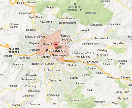
Map of Kathmandu Valley 

Map of Kathmandu
Google map of Kathmandu

The red covered area is  Ring Road and is the part where the main city lies. Kathmandu has many places to go around.
Many tourists come to Nepal for Trekking, Hiking and other adventure Sports. Pokhara is also one of the place which attracts most of the tourists.

Map of Pokhara


Most people stay at Lake side. Phewa Lake is the attraction for all the one. 

No comments:

Post a Comment